
So it’s been cold – in the 68-72F range – at the beach – which largely we were expecting to be hotter. It’s not humid at all – very comfortable. We’ve been wearing sweatshirts and shorts – it’s nice but not 100% of what we were thinking. When we were walking yesterday I asked everyone – hey – if we were in the US where do you think we would be? Answers were San Francisco, Maryland (Cindy), Oregon (me), etc. When Gavin was on Skype with his class they wanted to know where he was – it’s hard to explain. it’s also hard to visualize why we are 4 hours ahead of Colorado, etc.
So here ya go – the red pin in the map is our coordinates if we were in the Northern Hemisphere vs Southern. You can see the ‘blue dot’ in Chile – that’s us. It looks like we are about the same Latitude as South/North Carolina Border. Having been in South Carolina in the summer I can tell you that this is not South Carolina – much cooler, no humidity, etc. Anyway this will give you a greater sense of where we are… What’s interesting is that I want to map the tip of south america to see where it is against North America – doesn’t seem like it would be close to Alaska even – given our coordinates.
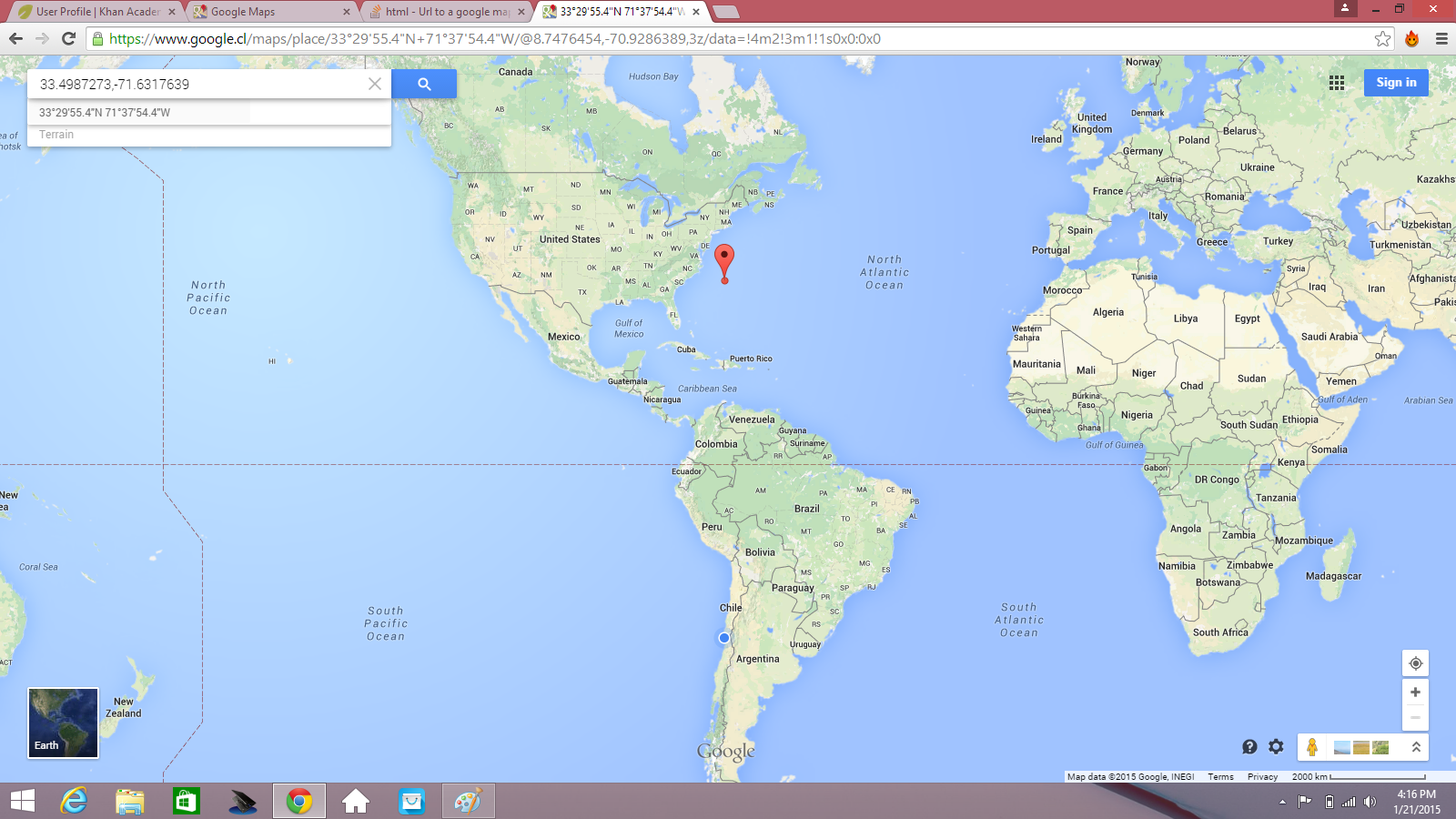
our Lat/Lon moved to Northern Hemishphere


![IMG_4793[1]](https://travellingoutlaws.com/wp-content/uploads/2015/01/img_47931.jpg)
![IMG_4797[1]](https://travellingoutlaws.com/wp-content/uploads/2015/01/img_47971.jpg)
![IMG_4795[1]](https://travellingoutlaws.com/wp-content/uploads/2015/01/img_47951.jpg)
![IMG_4792[1]](https://travellingoutlaws.com/wp-content/uploads/2015/01/img_47921.jpg)
